
Hot District topographic map
Interactive map
Click on the map to display elevation.
About this map
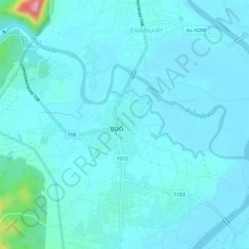
Name: Hot District topographic map, elevation, terrain.
Location: Hot District, Chiang Mai Province, 50240, Thailand (18.17414 98.59297 18.21414 98.63297)
Average elevation: 279 m
Minimum elevation: 259 m
Maximum elevation: 465 m
Other topographic maps
Click on a map to view its topography, its elevation and its terrain.
Mae Rim
Thailand > Chiang Mai Province
Mae Rim, Rim Nuea, Chiang Mai Province, 50180, Thailand
Average elevation: 340 m
Doi Pha Hom Pok National Park
Thailand > Chiang Mai Province > Ban Huey Mak Liam
Doi Pha Hom Pok National Park, ชม.3015, Ban Huey Mak Liam, Chiang Mai Province, Thailand
Average elevation: 847 m