
Thank you for supporting this site ❤️
Make a donation
Make a donation
Matanzas topographic map
Click on the map to display elevation.
Thank you for supporting this site ❤️
Make a donation
Make a donation
About this map
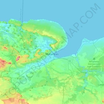
Name: Matanzas topographic map, elevation, terrain.
Location: Matanzas, Cuba (22.95101 -81.75083 23.15357 -81.40643)
Average elevation: 54 m
Minimum elevation: 0 m
Maximum elevation: 367 m
Thank you for supporting this site ❤️
Make a donation
Make a donation