
Thank you for supporting this site ❤️
Make a donation
Make a donation
Kawayan Cove topographic map
Click on the map to display elevation.
Thank you for supporting this site ❤️
Make a donation
Make a donation
About this map
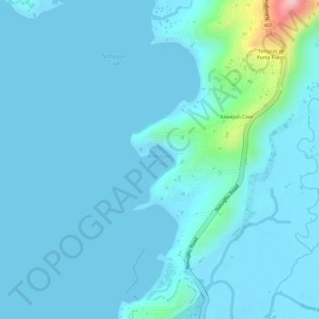
Name: Kawayan Cove topographic map, elevation, terrain.
Location: Kawayan Cove, Nasugbu, Batangas, Calabarzon, Philippines (14.10197 120.62064 14.10207 120.62074)
Average elevation: 22 m
Minimum elevation: 0 m
Maximum elevation: 229 m
Thank you for supporting this site ❤️
Make a donation
Make a donation
Other topographic maps
Click on a map to view its topography, its elevation and its terrain.