
Thank you for supporting this site ❤️
Make a donation
Make a donation
Puketutu Island topographic map
Click on the map to display elevation.
Thank you for supporting this site ❤️
Make a donation
Make a donation
About this map
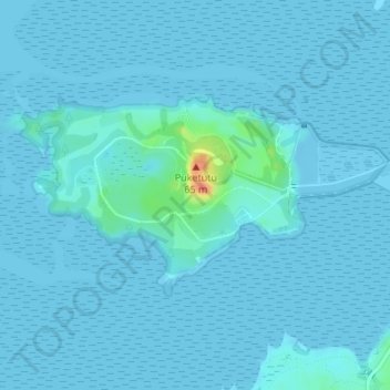
Name: Puketutu Island topographic map, elevation, terrain.
Location: Puketutu Island, Māngere-Ōtāhuhu, Auckland, New Zealand (-36.97400 174.73244 -36.95997 174.76440)
Average elevation: 3 m
Minimum elevation: -2 m
Maximum elevation: 54 m
Auckland trails, hiking, mountain biking, running and outdoor activities
Thank you for supporting this site ❤️
Make a donation
Make a donation
Other topographic maps
Click on a map to view its topography, its elevation and its terrain.