
Thank you for supporting this site ❤️
Make a donation
Make a donation
Rancho Peñasquitos topographic map
Click on the map to display elevation.
Thank you for supporting this site ❤️
Make a donation
Make a donation
Rancho Peñasquitos
The highest point in the community is Black Mountain, which rises to an elevation of 1,500 feet (460 m).
Thank you for supporting this site ❤️
Make a donation
Make a donation
About this map
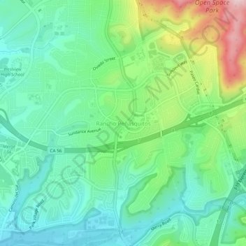
Name: Rancho Peñasquitos topographic map, elevation, terrain.
Average elevation: 157 m
Minimum elevation: 62 m
Maximum elevation: 385 m
Thank you for supporting this site ❤️
Make a donation
Make a donation