
Thank you for supporting this site ❤️
Make a donation
Make a donation
Fulton County topographic map
Click on the map to display elevation.
Thank you for supporting this site ❤️
Make a donation
Make a donation
About this map
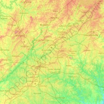
Name: Fulton County topographic map, elevation, terrain.
Location: Fulton County, Georgia, United States (33.50251 -84.85071 34.18629 -84.09769)
Average elevation: 289 m
Minimum elevation: 168 m
Maximum elevation: 512 m
Thank you for supporting this site ❤️
Make a donation
Make a donation
Other topographic maps
Click on a map to view its topography, its elevation and its terrain.