
Thank you for supporting this site ❤️
Make a donation
Make a donation
Oras topographic map
Click on the map to display elevation.
Thank you for supporting this site ❤️
Make a donation
Make a donation
About this map
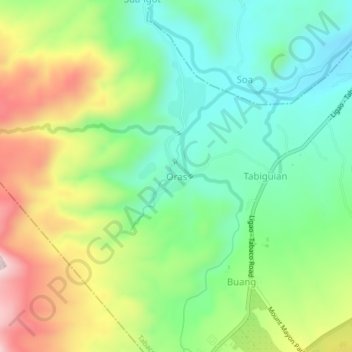
Name: Oras topographic map, elevation, terrain.
Location: Oras, Tabaco, Albay, Bicol Region, 4511, Philippines (13.30348 123.61416 13.34348 123.65416)
Average elevation: 232 m
Minimum elevation: 70 m
Maximum elevation: 503 m
Thank you for supporting this site ❤️
Make a donation
Make a donation