
Thank you for supporting this site ❤️
Make a donation
Make a donation
Monts de Fay topographic map
Click on the map to display elevation.
Thank you for supporting this site ❤️
Make a donation
Make a donation
About this map
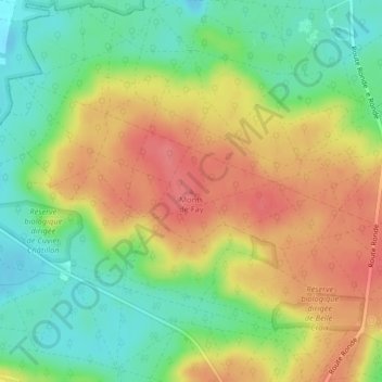
Name: Monts de Fay topographic map, elevation, terrain.
Average elevation: 114 m
Minimum elevation: 80 m
Maximum elevation: 148 m
Thank you for supporting this site ❤️
Make a donation
Make a donation
Other topographic maps
Click on a map to view its topography, its elevation and its terrain.
Réserve biologique dirigée de Cuvier Châtillon
France > Île-de-France > Seine-et-Marne > Fontainebleau
Average elevation: 102 m