
Thank you for supporting this site ❤️
Make a donation
Make a donation
Langgawisan topographic map
Click on the map to display elevation.
Thank you for supporting this site ❤️
Make a donation
Make a donation
About this map
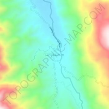
Name: Langgawisan topographic map, elevation, terrain.
Location: Langgawisan, Davao de Oro, Davao Region, Philippines (7.31964 126.20919 7.35964 126.24919)
Average elevation: 1,149 m
Minimum elevation: 928 m
Maximum elevation: 1,588 m
Thank you for supporting this site ❤️
Make a donation
Make a donation
Other topographic maps
Click on a map to view its topography, its elevation and its terrain.