
Thank you for supporting this site ❤️
Make a donation
Make a donation
Balamban topographic map
Click on the map to display elevation.
Thank you for supporting this site ❤️
Make a donation
Make a donation
About this map
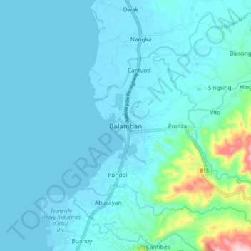
Name: Balamban topographic map, elevation, terrain.
Location: Balamban, Cebu, Central Visayas, 6041, Philippines (10.46489 123.67482 10.54489 123.75482)
Average elevation: 28 m
Minimum elevation: -2 m
Maximum elevation: 257 m
Thank you for supporting this site ❤️
Make a donation
Make a donation
Other topographic maps
Click on a map to view its topography, its elevation and its terrain.