
Waihola Hill topographic map
Interactive map
Click on the map to display elevation.
About this map
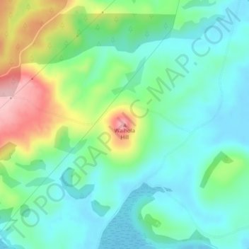
Name: Waihola Hill topographic map, elevation, terrain.
Location: Waihola Hill, Clutha District, Otago, 9243, New Zealand (-46.00530 170.05739 -46.00520 170.05749)
Average elevation: 55 m
Minimum elevation: -3 m
Maximum elevation: 189 m
Clutha District trails, hiking, mountain biking, running and outdoor activities
Other topographic maps
Click on a map to view its topography, its elevation and its terrain.