
Thank you for supporting this site ❤️
Make a donation
Make a donation
Rangitihi topographic map
Click on the map to display elevation.
Thank you for supporting this site ❤️
Make a donation
Make a donation
About this map
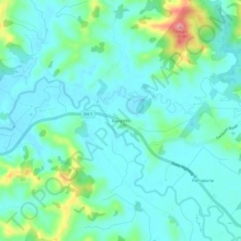
Name: Rangitihi topographic map, elevation, terrain.
Average elevation: 45 m
Minimum elevation: 21 m
Maximum elevation: 136 m
Far North District trails, hiking, mountain biking, running and outdoor activities
Thank you for supporting this site ❤️
Make a donation
Make a donation
Other topographic maps
Click on a map to view its topography, its elevation and its terrain.
Waiparera Stream
New Zealand > Northland > Far North District > Te Hiku Community
Average elevation: 5 m