
Thank you for supporting this site ❤️
Make a donation
Make a donation
Newell topographic map
Click on the map to display elevation.
Thank you for supporting this site ❤️
Make a donation
Make a donation
About this map
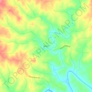
Name: Newell topographic map, elevation, terrain.
Location: Newell, Randolph County, Alabama, 36270, United States (33.41317 -85.45356 33.45317 -85.41356)
Average elevation: 286 m
Minimum elevation: 246 m
Maximum elevation: 329 m
Thank you for supporting this site ❤️
Make a donation
Make a donation