
Coalgate topographic map
Click on the map to display elevation.
About this map
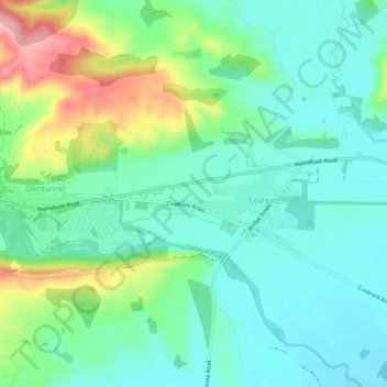
Name: Coalgate topographic map, elevation, terrain.
Location: Coalgate, Selwyn District, Canterbury, 7673, New Zealand (-43.50008 171.93616 -43.46008 171.97616)
Average elevation: 267 m
Minimum elevation: 218 m
Maximum elevation: 392 m
Canterbury trails, hiking, mountain biking, running and outdoor activities