
Thank you for supporting this site ❤️
Make a donation
Make a donation
Hailer topographic map
Click on the map to display elevation.
Thank you for supporting this site ❤️
Make a donation
Make a donation
About this map
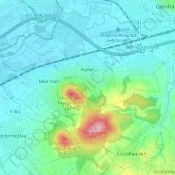
Name: Hailer topographic map, elevation, terrain.
Location: Hailer, Gelnhausen, Main-Kinzig-Kreis, Hesse, Germany (50.16284 9.12172 50.20109 9.19178)
Average elevation: 156 m
Minimum elevation: 122 m
Maximum elevation: 294 m
Thank you for supporting this site ❤️
Make a donation
Make a donation
Other topographic maps
Click on a map to view its topography, its elevation and its terrain.