
Thank you for supporting this site ❤️
Make a donation
Make a donation
Glendale topographic map
Click on the map to display elevation.
Thank you for supporting this site ❤️
Make a donation
Make a donation
About this map
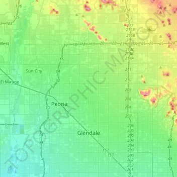
Name: Glendale topographic map, elevation, terrain.
Location: Glendale, Maricopa County, Arizona, United States (33.50779 -112.46156 33.69792 -112.15156)
Average elevation: 380 m
Minimum elevation: 294 m
Maximum elevation: 659 m
Thank you for supporting this site ❤️
Make a donation
Make a donation
Other topographic maps
Click on a map to view its topography, its elevation and its terrain.
Camelback Mountain
United States > Arizona > Maricopa County > Phoenix
Efforts to protect Camelback Mountain as a natural preserve began in the early 1910s. However, by the 1960s, nearly all of the area had been sold to private interests. Federal and state authorities attempted to stop development above the one thousand and six hundred feet level. They failed to halt development…
Average elevation: 462 m
Thank you for supporting this site ❤️
Make a donation
Make a donation