
Thank you for supporting this site ❤️
Make a donation
Make a donation
Balearic Islands topographic map
Click on the map to display elevation.
Thank you for supporting this site ❤️
Make a donation
Make a donation
About this map
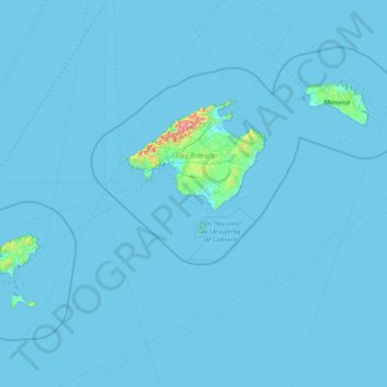
Name: Balearic Islands topographic map, elevation, terrain.
Location: Balearic Islands, Spain (38.64045 1.15727 40.09459 4.32803)
Average elevation: 9 m
Minimum elevation: -4 m
Maximum elevation: 1,317 m
Thank you for supporting this site ❤️
Make a donation
Make a donation