
Turiz topographic map
Interactive map
Click on the map to display elevation.
About this map
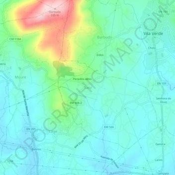
Name: Turiz topographic map, elevation, terrain.
Location: Turiz, Vila Verde, Braga, 4730-247 LAGE, Portugal (41.61640 -8.47636 41.65640 -8.43636)
Average elevation: 100 m
Minimum elevation: 35 m
Maximum elevation: 327 m
Other topographic maps
Click on a map to view its topography, its elevation and its terrain.
Penedos Altos
Portugal > Braga > Turiz > Turiz > Penedos Altos
Penedos Altos, Turiz, Vila Verde, Braga, 4730-247 LAGE, Portugal
Average elevation: 105 m