
Thank you for supporting this site ❤️
Make a donation
Make a donation
Kapel topographic map
Click on the map to display elevation.
Thank you for supporting this site ❤️
Make a donation
Make a donation
About this map
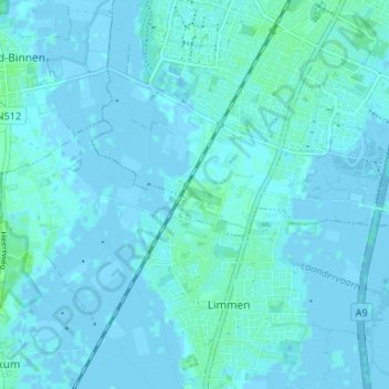
Name: Kapel topographic map, elevation, terrain.
Location: Kapel, Heiloo, North Holland, Netherlands, 1851 PM, Netherlands (52.56323 4.66799 52.60323 4.70799)
Average elevation: 1 m
Minimum elevation: -3 m
Maximum elevation: 7 m
Thank you for supporting this site ❤️
Make a donation
Make a donation