
Thank you for supporting this site ❤️
Make a donation
Make a donation
Thailand topographic map
Click on the map to display elevation.
Thank you for supporting this site ❤️
Make a donation
Make a donation
About this map
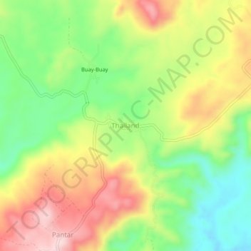
Name: Thailand topographic map, elevation, terrain.
Location: Thailand, Banisilan, North Cotabato, Soccsksargen, Philippines (7.47319 124.70470 7.51319 124.74470)
Average elevation: 408 m
Minimum elevation: 270 m
Maximum elevation: 569 m
Thank you for supporting this site ❤️
Make a donation
Make a donation