
Bergama topographic map
Interactive map
Click on the map to display elevation.
About this map
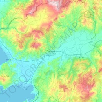
Name: Bergama topographic map, elevation, terrain.
Location: Bergama, Izmir, Aegean Region, 35700, Turkey (38.85149 26.88726 39.38549 27.48048)
Average elevation: 323 m
Minimum elevation: -2 m
Maximum elevation: 1,326 m
Other topographic maps
Click on a map to view its topography, its elevation and its terrain.
Demircidere
Turkey > Bergama > Demircidere
Demircidere, Bergama, Izmir, Aegean Region, Turkey
Average elevation: 301 m