
Chinchiná topographic map
Interactive map
Click on the map to display elevation.
About this map
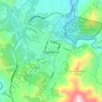
Name: Chinchiná topographic map, elevation, terrain.
Location: Chinchiná, Centrosur, Caldas, 176020, Colombia (4.96484 -75.62174 5.00195 -75.59266)
Average elevation: 1,406 m
Minimum elevation: 1,244 m
Maximum elevation: 1,824 m