
Bridge of Allan topographic map
Interactive map
Click on the map to display elevation.
About this map
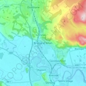
Name: Bridge of Allan topographic map, elevation, terrain.
Location: Bridge of Allan, Stirling, Schotland, FK9, Verenigd Koninkrijk (56.11504 -3.98807 56.19504 -3.90807)
Average elevation: 80 m
Minimum elevation: -1 m
Maximum elevation: 416 m