
Thank you for supporting this site ❤️
Make a donation
Make a donation
Calvert County topographic map
Click on the map to display elevation.
Thank you for supporting this site ❤️
Make a donation
Make a donation
About this map
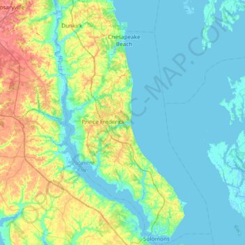
Name: Calvert County topographic map, elevation, terrain.
Location: Calvert County, Maryland, United States (38.30574 -76.70201 38.76930 -76.32172)
Average elevation: 18 m
Minimum elevation: -4 m
Maximum elevation: 84 m
Thank you for supporting this site ❤️
Make a donation
Make a donation