
Thank you for supporting this site ❤️
Make a donation
Make a donation
Incahuasi topographic map
Click on the map to display elevation.
Thank you for supporting this site ❤️
Make a donation
Make a donation
About this map
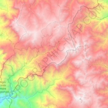
Name: Incahuasi topographic map, elevation, terrain.
Location: Incahuasi, Ferreñafe, Lambayeque, Perú (-6.40198 -79.54336 -6.07403 -79.24909)
Average elevation: 2,663 m
Minimum elevation: 301 m
Maximum elevation: 4,098 m
Thank you for supporting this site ❤️
Make a donation
Make a donation
Other topographic maps
Click on a map to view its topography, its elevation and its terrain.