
Thank you for supporting this site ❤️
Make a donation
Make a donation
Pot topographic map
Click on the map to display elevation.
Thank you for supporting this site ❤️
Make a donation
Make a donation
About this map
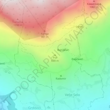
Name: Pot topographic map, elevation, terrain.
Location: Pot, Velje Selo, Bar Municipality, 85356, Montenegro (42.04346 19.19203 42.04356 19.19213)
Average elevation: 607 m
Minimum elevation: 187 m
Maximum elevation: 1,233 m
Thank you for supporting this site ❤️
Make a donation
Make a donation