
Arradoul topographic map
Interactive map
Click on the map to display elevation.
About this map
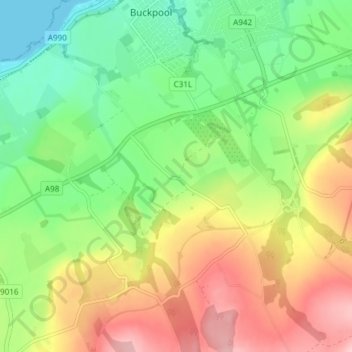
Name: Arradoul topographic map, elevation, terrain.
Location: Arradoul, Buckie, Moray, Scotland, AB56 5AP, United Kingdom (57.63286 -2.99338 57.67286 -2.95338)
Average elevation: 71 m
Minimum elevation: 0 m
Maximum elevation: 167 m