
Thank you for supporting this site ❤️
Make a donation
Make a donation
Gloria topographic map
Click on the map to display elevation.
Thank you for supporting this site ❤️
Make a donation
Make a donation
About this map
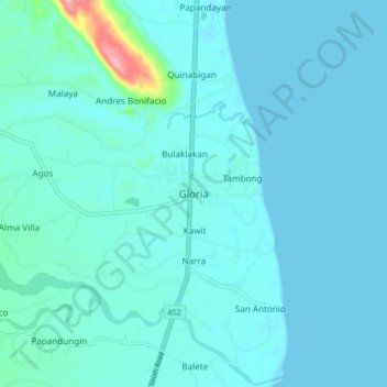
Name: Gloria topographic map, elevation, terrain.
Location: Gloria, Oriental Mindoro, Mimaropa, 5213, Philippines (12.92885 121.43853 13.00885 121.51853)
Average elevation: 12 m
Minimum elevation: 0 m
Maximum elevation: 132 m
Thank you for supporting this site ❤️
Make a donation
Make a donation
Other topographic maps
Click on a map to view its topography, its elevation and its terrain.