
Thank you for supporting this site ❤️
Make a donation
Make a donation
Budaörs topographic map
Click on the map to display elevation.
Thank you for supporting this site ❤️
Make a donation
Make a donation
About this map
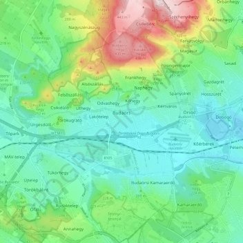
Name: Budaörs topographic map, elevation, terrain.
Location: Budaörs, Budakeszi járás, Pest, Central Hungary, Hungary (47.42782 18.87415 47.48642 18.98267)
Average elevation: 205 m
Minimum elevation: 107 m
Maximum elevation: 463 m
Thank you for supporting this site ❤️
Make a donation
Make a donation