
Thank you for supporting this site ❤️
Make a donation
Make a donation
Halswell-Hornby-Riccarton Community topographic map
Click on the map to display elevation.
Thank you for supporting this site ❤️
Make a donation
Make a donation
About this map
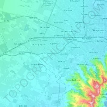
Name: Halswell-Hornby-Riccarton Community topographic map, elevation, terrain.
Average elevation: 49 m
Minimum elevation: 0 m
Maximum elevation: 526 m
Thank you for supporting this site ❤️
Make a donation
Make a donation
Other topographic maps
Click on a map to view its topography, its elevation and its terrain.
Ohinepaka Bay
New Zealand > Canterbury > Christchurch City > Banks Peninsula Community > Wainui
Average elevation: 94 m
Zig Zag
New Zealand > Canterbury > Christchurch City > Banks Peninsula Community
Average elevation: 136 m
Lyttelton
New Zealand > Canterbury > Christchurch City > Banks Peninsula Community
Average elevation: 99 m
Thank you for supporting this site ❤️
Make a donation
Make a donation