
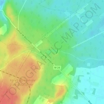
Lac de la Bordette topographic map
Interactive map
Click on the map to display elevation.
About this map
Name: Lac de la Bordette topographic map, elevation, terrain.
Average elevation: 206 m
Minimum elevation: 186 m
Maximum elevation: 237 m
Other topographic maps
Click on a map to view its topography, its elevation and its terrain.
Peyrolles
France > Occitanie > Haute-Garonne > Pibrac
Peyrolles, Pibrac, Toulouse, Haute-Garonne, Occitanie, France métropolitaine, 31820, France
Average elevation: 193 m
Château de Pibrac
France > Occitanie > Haute-Garonne > Pibrac
Château de Pibrac, Rue de la Gare, Pibrac, Toulouse, Haute-Garonne, Occitanie, France métropolitaine, 31820, France
Average elevation: 176 m
Peyrolles
France > Occitanie > Haute-Garonne > Pibrac
Peyrolles, Pibrac, Toulouse, Haute-Garonne, Occitanie, France métropolitaine, 31820, France
Average elevation: 193 m