
Thank you for supporting this site ❤️
Make a donation
Make a donation
Kuku ward topographic map
Click on the map to display elevation.
Thank you for supporting this site ❤️
Make a donation
Make a donation
About this map
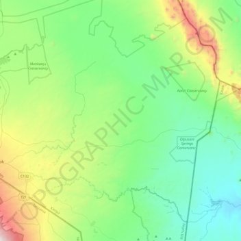
Name: Kuku ward topographic map, elevation, terrain.
Location: Kuku ward, Loitokitok, Rift Valley, Kenya (-3.04199 37.47934 -2.65616 37.93793)
Average elevation: 1,183 m
Minimum elevation: 707 m
Maximum elevation: 2,631 m
Thank you for supporting this site ❤️
Make a donation
Make a donation
Other topographic maps
Click on a map to view its topography, its elevation and its terrain.