
Thank you for supporting this site ❤️
Make a donation
Make a donation
Tak topographic map
Click on the map to display elevation.
Thank you for supporting this site ❤️
Make a donation
Make a donation
About this map
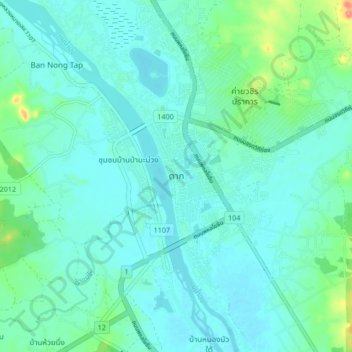
Name: Tak topographic map, elevation, terrain.
Location: Tak, Nong Bua Tai, Tak Province, 63000, Thailand (16.83226 99.08484 16.91226 99.16484)
Average elevation: 121 m
Minimum elevation: 105 m
Maximum elevation: 200 m
Thank you for supporting this site ❤️
Make a donation
Make a donation