
Thank you for supporting this site ❤️
Make a donation
Make a donation
Bradley topographic map
Click on the map to display elevation.
Thank you for supporting this site ❤️
Make a donation
Make a donation
About this map
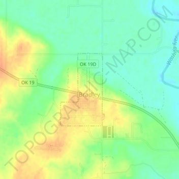
Name: Bradley topographic map, elevation, terrain.
Location: Bradley, Grady County, Oklahoma, United States (34.87332 -97.71348 34.88426 -97.70539)
Average elevation: 317 m
Minimum elevation: 299 m
Maximum elevation: 339 m
Thank you for supporting this site ❤️
Make a donation
Make a donation
Other topographic maps
Click on a map to view its topography, its elevation and its terrain.