
Oakura Bay topographic map
Interactive map
Click on the map to display elevation.
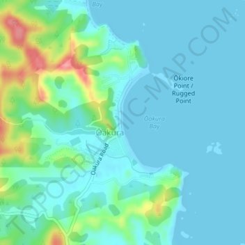
Oakura Bay topographic map, elevation, terrain
About this map
Name: Oakura Bay topographic map, elevation, terrain.
Average elevation: 20 m
Minimum elevation: 0 m
Maximum elevation: 103 m
Routes: Whangarei District GPS tracks, routes, trails, hikes