
Saint Mary's County topographic map
Interactive map
Click on the map to display elevation.
About this map
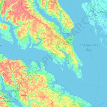
Name: Saint Mary's County topographic map, elevation, terrain.
Location: Saint Mary's County, Maryland, United States of America (37.89033 -76.87435 38.51371 -76.19967)
Average elevation: 13 m
Minimum elevation: -4 m
Maximum elevation: 62 m
Other topographic maps
Click on a map to view its topography, its elevation and its terrain.
Prince George's County
United States of America > Maryland
Prince George's County, Maryland, United States of America
Average elevation: 45 m
Baltimore County
United States of America > Maryland
Baltimore County, Maryland, United States of America
Average elevation: 123 m
Honeysuckle Ridge
United States of America > Maryland > Honeysuckle Ridge
Honeysuckle Ridge, Anne Arundel County, Maryland, 21032, United States of America
Average elevation: 31 m