
Utqiagvik topographic map
Interactive map
Click on the map to display elevation.
About this map
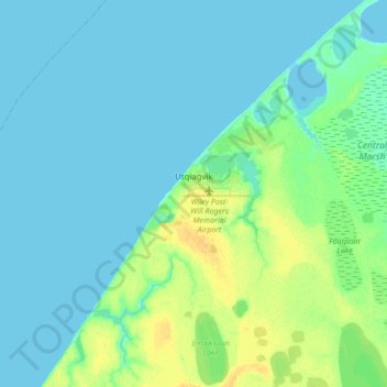
Name: Utqiagvik topographic map, elevation, terrain.
Location: Utqiagvik, North Slope, Alaska, United States of America (71.23029 -156.92450 71.34026 -156.63934)
Average elevation: 4 m
Minimum elevation: 0 m
Maximum elevation: 18 m
Despite the extreme northern location, temperatures at Utqiaġvik are moderated by the surrounding topography. The Arctic Ocean is on three sides, and flat tundra stretches some 200 miles (300 km) to the south. There are no wind barriers or protected valleys where dense cold air can settle or form temperature inversions in the lower atmosphere, as commonly happens in the interior between the Brooks and the Alaska ranges.