
Port Pirie Regional Council topographic map
Interactive map
Click on the map to display elevation.
About this map
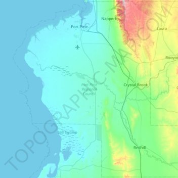
Name: Port Pirie Regional Council topographic map, elevation, terrain.
Location: Port Pirie Regional Council, South Australia, Australia (-33.62630 137.81000 -33.10382 138.40318)
Average elevation: 93 m
Minimum elevation: -1 m
Maximum elevation: 715 m
Other topographic maps
Click on a map to view its topography, its elevation and its terrain.