
Thank you for supporting this site ❤️
Make a donation
Make a donation
Mangudadatu topographic map
Click on the map to display elevation.
Thank you for supporting this site ❤️
Make a donation
Make a donation
About this map
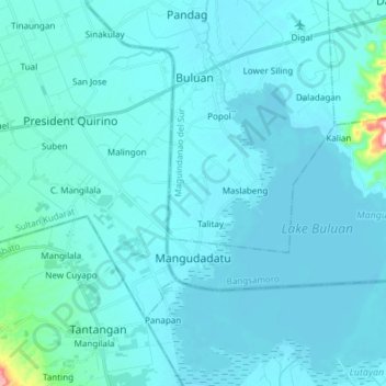
Name: Mangudadatu topographic map, elevation, terrain.
Location: Mangudadatu, Maguindanao del Sur, Bangsamoro, Philippines (6.63428 124.77577 6.70966 124.92629)
Average elevation: 24 m
Minimum elevation: 6 m
Maximum elevation: 303 m
Thank you for supporting this site ❤️
Make a donation
Make a donation
Other topographic maps
Click on a map to view its topography, its elevation and its terrain.