
Thank you for supporting this site ❤️
Make a donation
Make a donation
Yeager topographic map
Click on the map to display elevation.
Thank you for supporting this site ❤️
Make a donation
Make a donation
Yeager
The town lies at an elevation of 870 feet above sea level and has an average of 39 inches of rain and 6.1 inches of snowfall annually.
Thank you for supporting this site ❤️
Make a donation
Make a donation
About this map
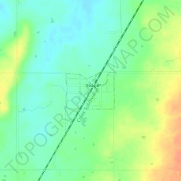
Name: Yeager topographic map, elevation, terrain.
Location: Yeager, Hughes County, Oklahoma, United States (35.15402 -96.34444 35.15957 -96.33567)
Average elevation: 245 m
Minimum elevation: 229 m
Maximum elevation: 268 m
Thank you for supporting this site ❤️
Make a donation
Make a donation