
Thank you for supporting this site ❤️
Make a donation
Make a donation
Riverpark topographic map
Click on the map to display elevation.
Thank you for supporting this site ❤️
Make a donation
Make a donation
About this map
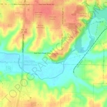
Name: Riverpark topographic map, elevation, terrain.
Location: Riverpark, Greene County, Missouri, 65810, United States (37.07783 -93.30324 37.11783 -93.26324)
Average elevation: 370 m
Minimum elevation: 339 m
Maximum elevation: 400 m
Thank you for supporting this site ❤️
Make a donation
Make a donation