
Thank you for supporting this site ❤️
Make a donation
Make a donation
Sambikerep topographic map
Click on the map to display elevation.
Thank you for supporting this site ❤️
Make a donation
Make a donation
About this map
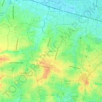
Name: Sambikerep topographic map, elevation, terrain.
Location: Sambikerep, Surabaya, East Java, Java, Indonesia (-7.29255 112.62639 -7.25764 112.68412)
Average elevation: 18 m
Minimum elevation: 1 m
Maximum elevation: 38 m
Thank you for supporting this site ❤️
Make a donation
Make a donation