
Thank you for supporting this site ❤️
Make a donation
Make a donation
Bois Court topographic map
Click on the map to display elevation.
Thank you for supporting this site ❤️
Make a donation
Make a donation
About this map
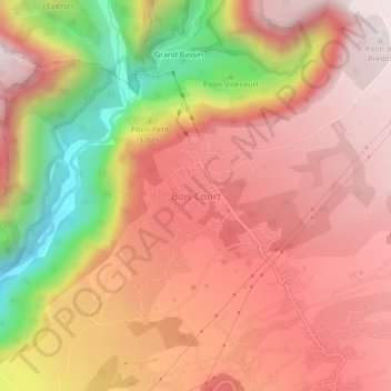
Name: Bois Court topographic map, elevation, terrain.
Location: Bois Court, Le Tampon, Saint-Pierre, Réunion, 97418, France (-21.21661 55.51638 -21.17661 55.55638)
Average elevation: 1,182 m
Minimum elevation: 473 m
Maximum elevation: 1,588 m
Thank you for supporting this site ❤️
Make a donation
Make a donation