
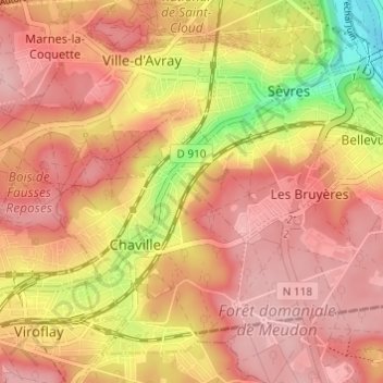
Val Saint-Olaf topographic map
Interactive map
Click on the map to display elevation.
About this map
Name: Val Saint-Olaf topographic map, elevation, terrain.
Average elevation: 128 m
Minimum elevation: 23 m
Maximum elevation: 180 m
Other topographic maps
Click on a map to view its topography, its elevation and its terrain.
92370
France > Île-de-France > Hauts-de-Seine > Chaville > Val Saint-Olaf
92370, Val Saint-Olaf, Chaville, Boulogne-Billancourt, Hauts-de-Seine, Île-de-France, France métropolitaine, France
Average elevation: 129 m
Cité des Châtres Sacs
France > Île-de-France > Hauts-de-Seine > Chaville
Cité des Châtres Sacs, Chaville, Boulogne-Billancourt, Hauts-de-Seine, Île-de-France, France métropolitaine, 92370, France
Average elevation: 124 m