
Thank you for supporting this site ❤️
Make a donation
Make a donation
Quetta topographic map
Click on the map to display elevation.
Thank you for supporting this site ❤️
Make a donation
Make a donation
About this map
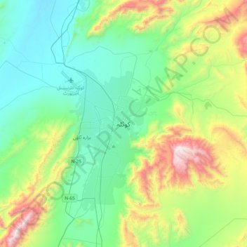
Name: Quetta topographic map, elevation, terrain.
Location: Quetta, Balochistan, 87300, Pakistan (30.03577 66.85724 30.35577 67.17724)
Average elevation: 1,968 m
Minimum elevation: 1,538 m
Maximum elevation: 3,180 m
Thank you for supporting this site ❤️
Make a donation
Make a donation
Other topographic maps
Click on a map to view its topography, its elevation and its terrain.