
Westminster Park topographic map
Interactive map
Click on the map to display elevation.
About this map
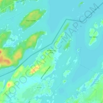
Name: Westminster Park topographic map, elevation, terrain.
Location: Westminster Park, Jefferson County, New York, 13607, USA (44.33616 -75.94968 44.37616 -75.90968)
Average elevation: 79 m
Minimum elevation: 71 m
Maximum elevation: 110 m
Other topographic maps
Click on a map to view its topography, its elevation and its terrain.
Mary Island State Park
USA > New York > Westminster Park
Mary Island State Park, Westminster Park, Jefferson County, New York, USA
Average elevation: 76 m