
Thank you for supporting this site ❤️
Make a donation
Make a donation
Recesende topographic map
Click on the map to display elevation.
Thank you for supporting this site ❤️
Make a donation
Make a donation
About this map
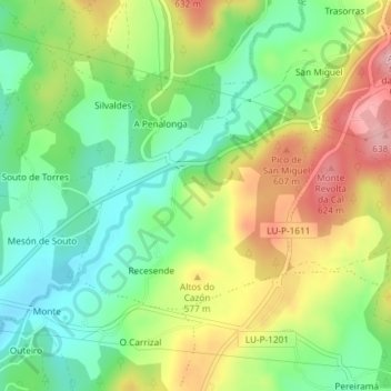
Name: Recesende topographic map, elevation, terrain.
Location: Recesende, Castroverde, Lugo, Galicia, España (43.01019 -7.36109 43.02591 -7.33827)
Average elevation: 539 m
Minimum elevation: 471 m
Maximum elevation: 634 m
Thank you for supporting this site ❤️
Make a donation
Make a donation
Other topographic maps
Click on a map to view its topography, its elevation and its terrain.