
Zrenjanin topographic map
Interactive map
Click on the map to display elevation.
About this map
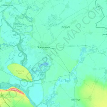
Name: Zrenjanin topographic map, elevation, terrain.
Location: Zrenjanin, Средњобанатски управни округ, Voïvodine, Serbie (45.07441 20.14728 45.61917 20.71917)
Average elevation: 83 m
Minimum elevation: 68 m
Maximum elevation: 263 m
Other topographic maps
Click on a map to view its topography, its elevation and its terrain.
Zrenjanin
Serbie > Voïvodine > Средњобанатски управни округ > Zrenjanin
Zrenjanin, Град Зрењанин, Средњобанатски управни округ, Voïvodine, 23110, Serbie
Average elevation: 80 m