
Thank you for supporting this site ❤️
Make a donation
Make a donation
Nangka topographic map
Click on the map to display elevation.
Thank you for supporting this site ❤️
Make a donation
Make a donation
About this map
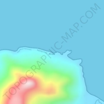
Name: Nangka topographic map, elevation, terrain.
Location: Nangka, West Kalimantan, Indonesia (-1.55005 108.93328 -1.54995 108.93338)
Average elevation: 74 m
Minimum elevation: 0 m
Maximum elevation: 454 m
Thank you for supporting this site ❤️
Make a donation
Make a donation