
Tiverton topographic map
Interactive map
Click on the map to display elevation.
About this map
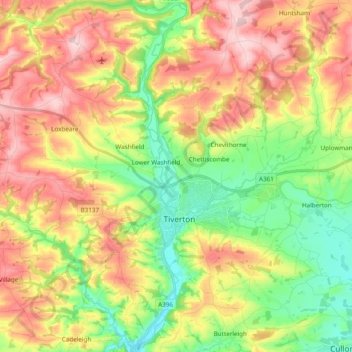
Name: Tiverton topographic map, elevation, terrain.
Location: Tiverton, Mid Devon, Devon, Angleterre, Royaume-Uni (50.85668 -3.58845 50.97798 -3.42387)
Average elevation: 156 m
Minimum elevation: 45 m
Maximum elevation: 288 m